An upper-level low-pressure system will continue to cross the Florida Peninsula, and most shower and thunderstorm activity will continue to affect the southern half of the state. The strongest activity and heaviest rainfall will likely remain focused across South Florida, where some areas could accumulate 2 to 4 inches of rain, with isolated spots receiving more than 6 inches throughout the weekend.

After a very gloomy Thursday, with nearly constant showers beginning the night before, Friday was not much different. Although the more widespread showers started shortly after noon on Friday, a few isolated showers moved across coastal areas of Palm Beach, Broward, and Miami-Dade counties during the morning.
Wild video of a waterspout moving onshore at Lighthouse Point Yacht Club just north of Fort Lauderdale, Florida today. Thankfully no damage or injuries reported.
— Brandon Orr (@BrandonOrrWPLG) September 18, 2026
📹: Sea Tow Fort Lauderdale pic.twitter.com/x4ywY0mRfV
The weather remained active on Friday, with even a waterspout forming just north of Fort Lauderdale. The waterspout then moved onshore, but luckily, there were no reports of injuries or damage.
Flooding at The Isles at Wellington #flwx @CBS12 @NWSMiami
— Lauren Olesky (@LoleskyWX) September 18, 2026
📷: Kimberly Joy pic.twitter.com/UBuIO7f6St
Rainfall totals between Tuesday and Friday:
- Metro Palm Beach County: 4–11 inches
- Metro Broward County: 2–7 inches
- Metro Miami-Dade County: 1–4 inches
- Metro Collier County: 2–4 inches
Thursday’s setup was exactly what we would need for several days to help alleviate the drought we have been experiencing. We’ll likely see significant improvement in the Drought Monitor report released next Thursday, September 24, as it will account for all the rain we’ve received since Tuesday across South Florida. Rainfall across Central Florida is also on the uptick, but not to the extent seen in South Florida.

While dry air has dominated the northern half of the peninsula, including the Panhandle, the southern half has remained rather soggy. This setup will continue throughout the weekend, especially across South and Central Florida. The difference will be that this moisture will slowly creep northward, allowing showers and thunderstorms to return to parts of North Florida this weekend. However, activity there will remain more scattered and less pronounced than across the southern portions of Central Florida, with the heaviest and most widespread activity expected over South Florida.
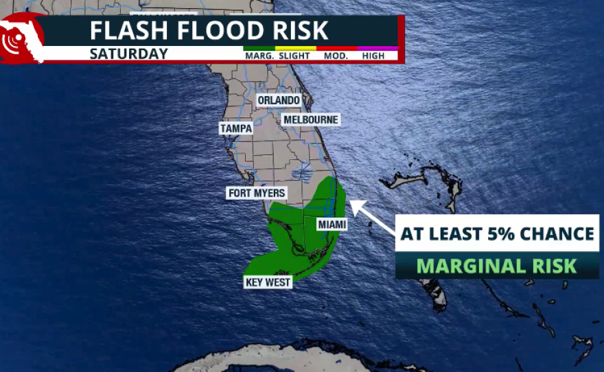
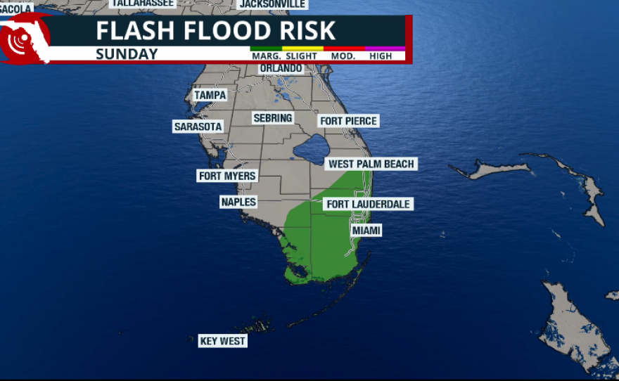
North Florida and the Panhandle will see more mixed weather, as pockets of dry air could still linger across the region. In South Florida, mornings may start partly sunny, but showers and thunderstorms will quickly develop each afternoon this weekend.
Make sure to stay away from flooded roads. The ground is already saturated from recent days of rain, and with the forecast still showing an active setup, storms could produce torrential rainfall and flooding, especially in flood-prone and low-lying areas. Some storms could also produce gusty winds and frequent lightning.
Winds are likely to pick up across the Space Coast and portions of eastern Central Florida on Saturday. Gusts could reach 25 mph at times. Winds will be coming onshore from the east, which will likely elevate the rip current risk along Florida’s East Coast. Make sure to stay out of the water if warning flags are being flown at the beach.
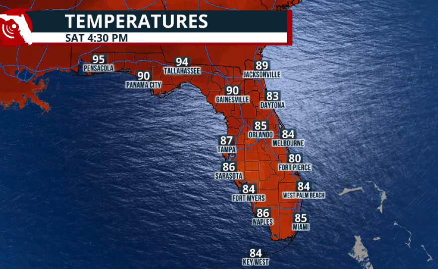
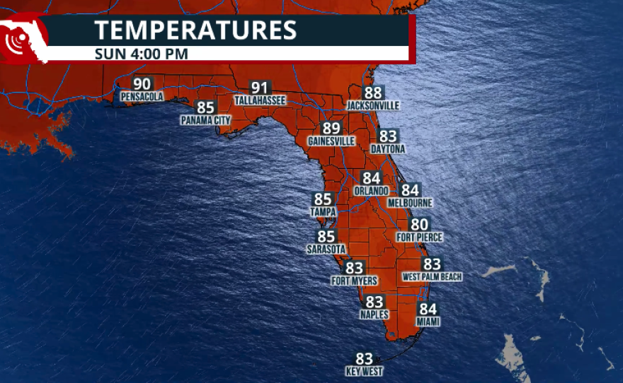
As for temperatures, this weekend will remain hot and humid across the peninsula. The difference is that across South Florida, temperatures will be largely influenced by cloud cover and thunderstorms, which will cool things off a bit at times. Across Central Florida, clouds will also increase during the afternoon, knocking temperatures down a few degrees, while thunderstorms could bring additional relief after 3 p.m. each day. Highs will likely reach the low 90s, but on Sunday, higher rain chances across Orlando and Tampa could keep temperatures in the upper 80s.