
It’s going to be a wet Monday across much of Florida with isolated to scattered severe thunderstorms that bring the risk for tornadoes, damaging winds of at least 58 miles per hour, and hail.
The cold front will push across North Florida on Monday morning through late Monday morning. Central Florida can expect an increase in some isolated severe thunderstorms by the early afternoon hours onward. South Florida could experience the heaviest downpours and isolated storms overnight Monday, going into Tuesday morning. Let’s break down the forecast region by region.
A strong cold front will push through Florida, bringing a chance for severe storms, much-needed rain, and a brief drop in temperatures. Some relief to our A/C units! Who's ready? pic.twitter.com/bK51Zo5vdi
— Florida Public Radio Emergency Network (FPREN) (@FloridaStorms) March 16, 2026
The Panhandle of Florida must be ready and have at least three ways to receive weather alerts early Monday morning. A line of strong to severe thunderstorms will cross Pensacola moving eastward between midnight and Monday early afternoon.
Keep in mind that according to the Storm Prediction Center, the western portion of the panhandle is under a slight risk for severe weather. This is category two out of five. Residents west of Tallahassee should monitor the front closely. The main threat of the severe thunderstorms will be tornadoes. There’s plenty of moisture that will continue to feed over the peninsula through North Florida and the Panhandle during the early start of Monday. All this moisture is prepping the atmosphere for numerous downpours across the peninsula throughout the day.


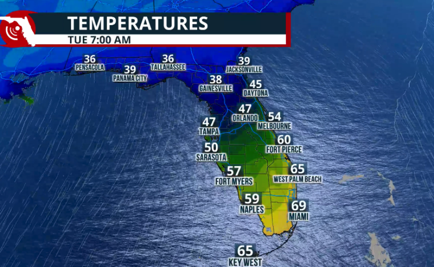
Across the Panhandle, temperatures will be dropping sharply on Monday night. By Monday afternoon, temperatures from Pensacola to Tallahassee will be in the 50s. By Monday night, temperatures will be quickly falling as the skies try to clear. Low temperatures on Tuesday morning will be around the mid-upper 30s from Tallahassee through Panama City to Pensacola.
North Florida
North Florida is also at a slight risk for severe storms, especially on Monday. The main threat with these storms will continue to be tornadoes developing across North Florida during the morning hours on Monday. Damaging winds of at least 58 mph will also be possible in any storms that develop tall enough well into the atmosphere, producing the strong gusts. Hail will also be a possibility as storms push through the region.

Once the cold front pushes through, expect the night to try to clear across North Florida on Monday night. There is still a very low chance of a brief passing shower on Monday night as the front pushes south. But by Tuesday morning, the winds will be mainly out of the north, gusty, and much colder temperatures will fill across the region.
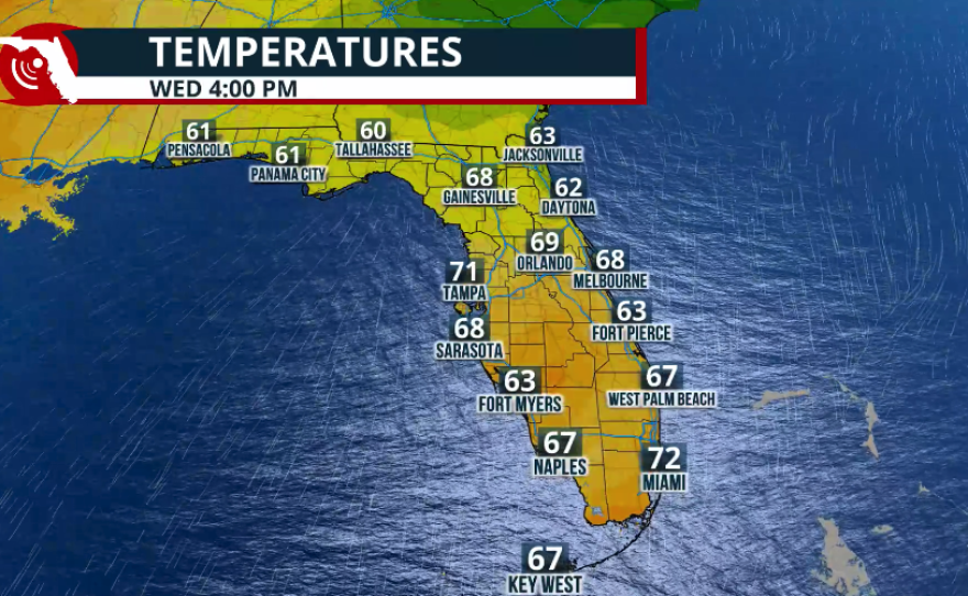
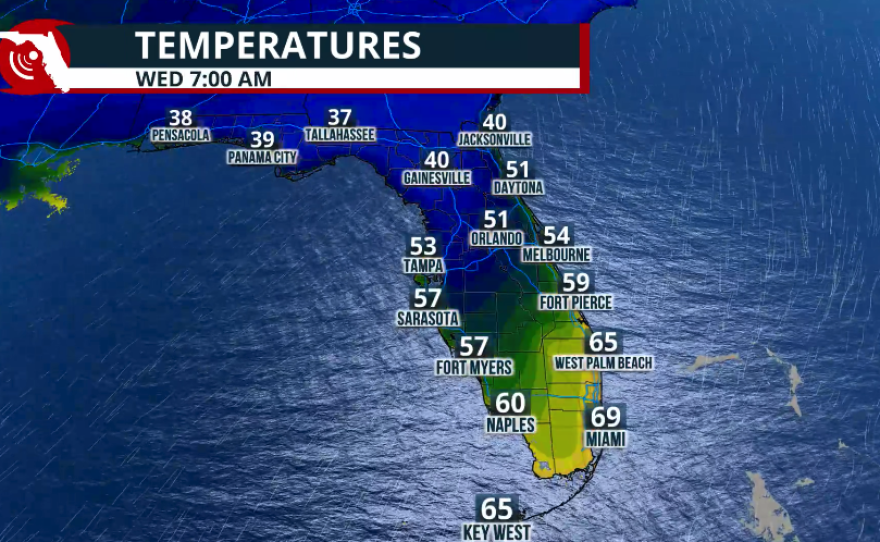
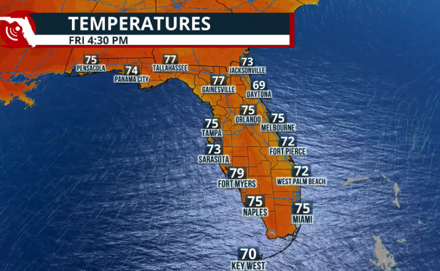
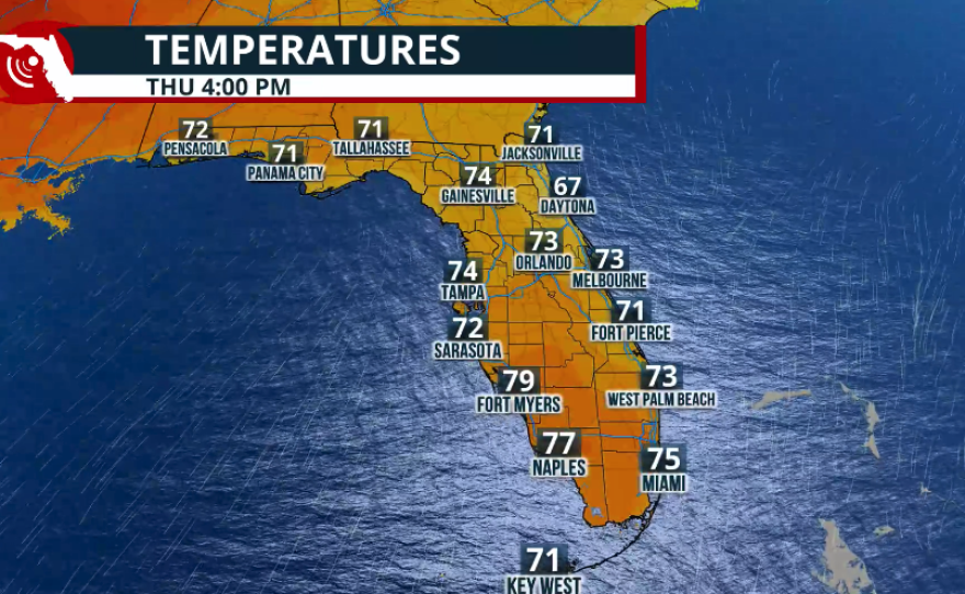
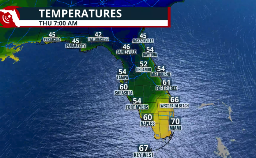
My Tuesday morning temperatures across North Florida will be between the upper 30s and low 40s. By Tuesday afternoon, expect a cool day with breezy conditions and highs in the upper 50s. Temperatures on Tuesday night into Wednesday morning will be around the low 40s. And as a wind change starts in the middle of the week, temperatures will slowly increase, bringing them back into the 70s starting Thursday.
Central Florida
Central Florida has seen numerous showers and thunderstorms on Sunday, and the chance for severe weather will be the highest between late morning and late afternoon. There is a marginal risk of severe storms developing. The main threats from any severe thunderstorm that develops will be damaging winds, gusts, and an isolated tornado. Since the moisture has lingered over Central Florida for the last few hours and will continue to stream in mainly from the south throughout much of the day on Monday, we expect the highest chance of numerous showers to also affect the Central Florida region. This means some areas could receive up to an inch and a half of rainfall through Tuesday afternoon. Low temperatures on Tuesday morning will be around the mid-40s across the I-4 corridor. The cultural will be starting to push just south of Central Florida on Tuesday morning, therefore a drastic contrast in temperatures in short distances between the southern portion of Central Florida through Lake Okeechobee.
South Florida
South Florida also had a soggy Sunday, and conditions will stay stormy on Monday and likely possibly stretching into Tuesday morning. The cold run, although strong, is starting to weaken a little. Its passage will cause a temperature drop even across South Florida. We do expect numerous showers and thunderstorms on Monday throughout the day, first because we have all this moisture coming in from the south before the cold front arrives early on Tuesday. Rainfall across South Florida will stay under an inch, but isolated spots could receive over an inch. Specifically, those storms that come in training one after the other, hidden in the same region over and over again.
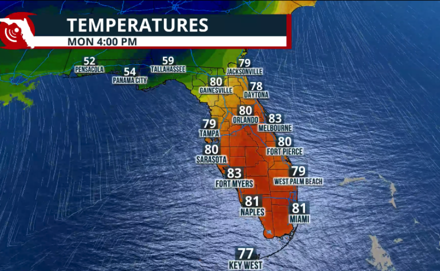
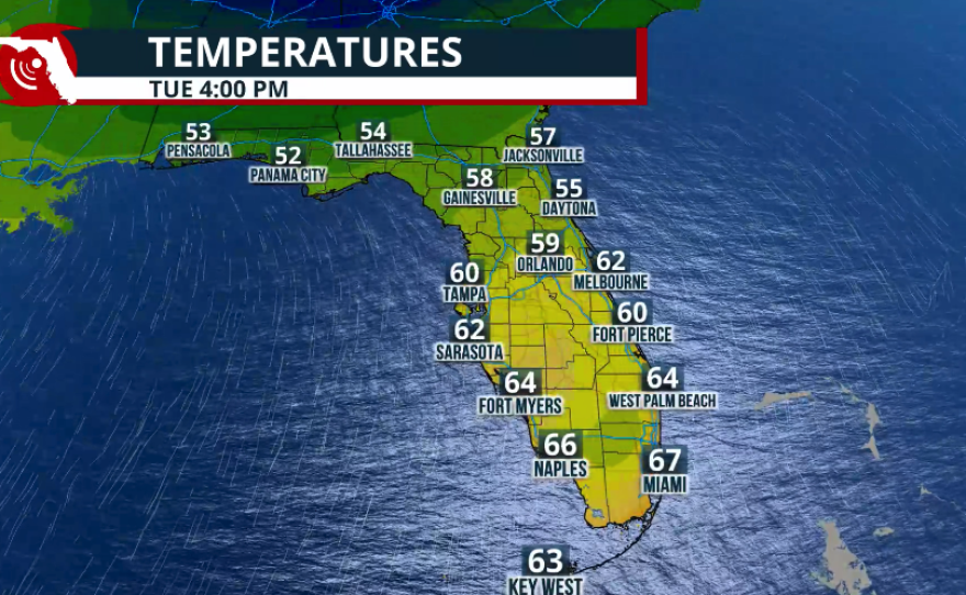
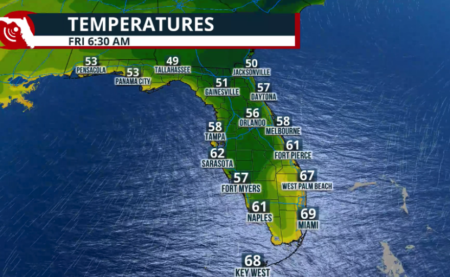
Temperatures across South Florida will still be toasty on Monday afternoon. Many regions will have highs between the low to mid 80s. By Tuesday morning, the weather will still be soggy and humid across South Florida. Temperatures will be in the upper 50s across southwest Florida, while the Treasure Coast, extending all the way through the Keys, will still be muggy in the evening and morning, with temperatures in the upper 60s. Temperatures will be dropping during the day on Tuesday and by the afternoon on Tuesday, temperatures will be much cooler, except for the afternoon, which will remain in the upper 60s, windier, and slowly clearing.

Marine hazards
Strong gusts from the south across the Peninsula will make the seas dangerous. As the cold front pushes through Florida, the winds will shift and mainly arrive from the north between Tuesday and late Wednesday. But they will shift on Thursday, mainly from the east, with temperatures gradually increasing. Please check the flags that may be up at your local beaches; there may also be a high risk of rip currents.
