The Thanksgiving holiday getaway is underway, with millions taking to cars, trains and planes to reach their destinations.
If travel experts’ outlooks are accurate, the busiest day for flights was Tuesday, while the overall busiest travel day will be Sunday, Nov. 30.
Just shy of 82 million Americans are expected to travel 50 miles or more to their destinations, which would set a record, according to AAA.

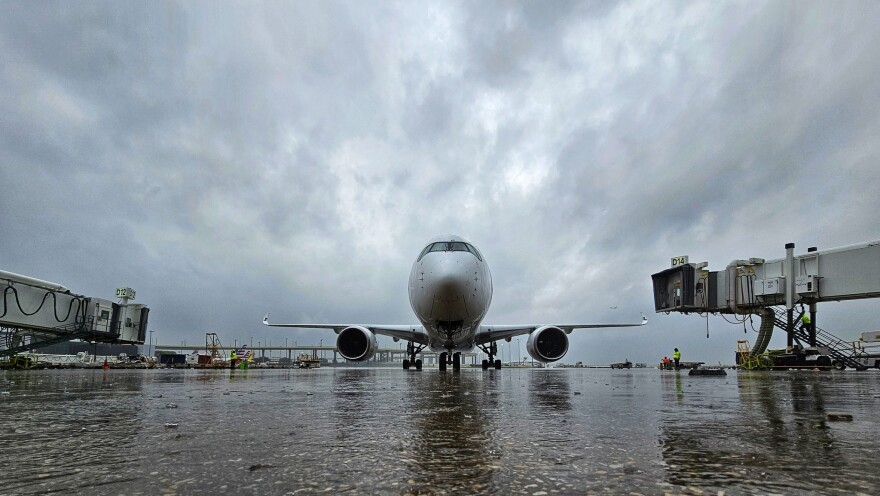
Showers and thunderstorms caused travel headaches on Monday across the Lone Star State, with delays and cancellations reported at Dallas–Fort Worth International (DFW), Dallas Love Field (DAL), George Bush Intercontinental Airport (IAH) and Houston’s William P. Hobby (HOU).
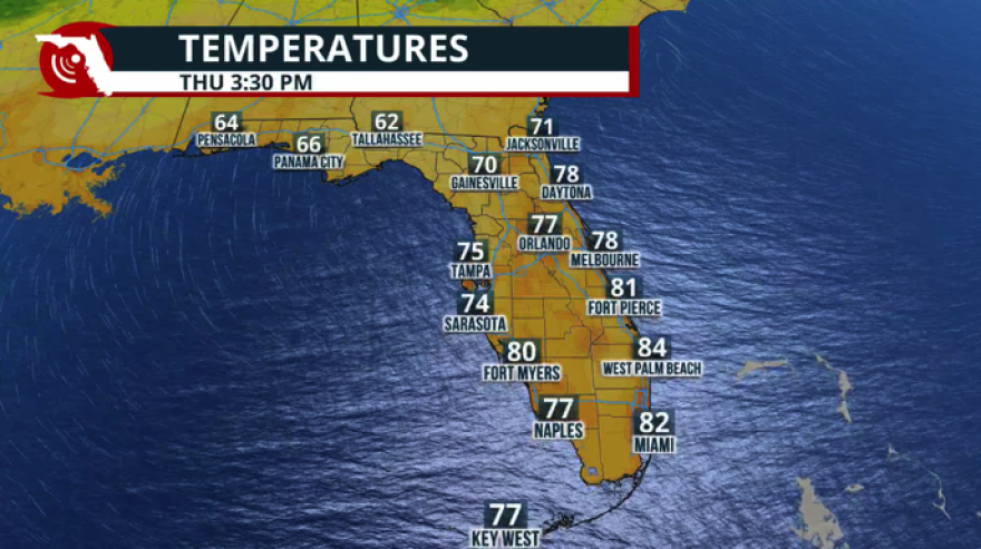
In Florida, warm overnight temperatures combined with moisture led to dense fog along I-10, I-75, I-4 and I-95, slowing traffic during the morning hours.
On Tuesday, near-blizzard conditions caused some roadways in the Upper Midwest to be shut down as a major storm system rolled through.
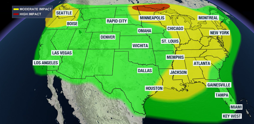
Sporadic weather hazards will continue across parts of the nation through the holiday, likely leading to additional issues.
Happening now:
Wednesday 7:00 p.m. update:
Chicago O'Hare International Airport continues to be problematic, with delays averaging at least around one hour.
Conditions in the Windy City are expected to improve on Thanksgiving Day, but communities south and east of the lakes will face the chance of lake-effect snow.
Several airports, including Minneapolis and Cleveland, have instituted de-icing programs, which can add to departure delays.

All eyes will be on New York City on Thursday morning for the annual Macy’s Thanksgiving Day Parade.
Temperatures will start out in the 30s, but the bigger issue will be the wind, with gusts reaching 30-40 mph.
Gusty conditions can impact parade operations, and it will be a scenario organizers will be watching closely.
Elsewhere around the country, the Pacific Northwest will see rain and snow ahead of the next cross-country storm system.

Previous updates:
Wednesday 10:30 a.m.:
Wednesday is expected to be one of the busiest road-travel days of the week for those driving 50 miles or more.
Most travel across the country won’t be affected by the storm system lifting into Canada, but a few trouble spots have already emerged.
Airports in Minneapolis and Albuquerque, New Mexico, are reporting delays due to de-icing and a ground stop was ordered at the Chicago O’Hare International Airport, which could lead to a domino effect of delays are the country.

Chicago recently reported sustained winds of 23 mph, with gusts up to 41 mph.
Wind gusts in the 40–50 mph range can dislodge small tree branches, leading to isolated power outages.
More than 60,000 outages were reported as of early Wednesday, with the highest concentrations in Wisconsin, Michigan and Minnesota.
WINTER ROAD CONDITIONS UPDATE: Partially covered and completely covered roads are being reported in parts of the state. Hazardous travel is expected across northern WI today through Thanksgiving due to heavy snow. Strong winds will cause blowing snow and reduced visibility. pic.twitter.com/oM0AVxLwGb
— Wisconsin DOT (@WisconsinDOT) November 26, 2025
Wednesday 12:00 a.m.:
Tuesday wrapped up with near-blizzard conditions across the Northern Plains, and cities such as Minneapolis, Milwaukee and Chicago bracing for snowfall.
Communities across the Great Lakes and Upper Midwest will face a blustery and cold Wednesday as the storm system moves through the region.
Fortunately, flight delays were fewer on Tuesday than earlier in the week but what was a benefit for some became a headache for others.
Many roadways across west-central Minnesota and eastern South Dakota were deemed too dangerous for travel due to blowing snow and poor visibilities.
⚠️NO TRAVEL ADVISED in West Central Minnesota ⚠️
— Minnesota Department of Transportation (@MnDOT) November 25, 2025
Due to dangerous travel conditions there is no travel advised in the areas in purple. Check https://t.co/yhtPwRf2sU for current travel information. pic.twitter.com/yZ6IteKqqH
A few rain showers are expected along the Eastern Seaboard on Wednesday but are not anticipated to cause significant travel delays.
Wednesday will be a transition day for many east of the Mississippi River, as the late-fall heat wave comes to an end when the powerful frontal boundary sweeps through.
With windy conditions expected to develop over the Great Lakes, lake-effect snow machines will kick into high gear on Thanksgiving Day.
If your travel plans take you along I-80 or points northward, you'll want to keep abreast of the weather situation.

Tuesday, 6:30 p.m.:
While most major airports are currently free of significant weather delays, impacts from the storm system sweeping across the nation are only beginning to ramp up.
Blizzard Warnings are now in effect for parts of South Dakota, Minnesota, Wisconsin and Michigan.
Forecast models indicate that 6-12 inches of snow are likely over the next 24 hours north of Interstate 90.
Blustery winds gusting up to 50 mph may lead to blowing and drifting snow - conditions that require Blizzard Warnings.
Interstate 29 is closed from Watertown to the North Dakota Boarder. Multiple jack-knifed semi-trucks and vehicle crashes that law enforcement is currently working on cleaning up. Most roadways in the northeast part of the state have zero visibility. Do not travel. #keepSDsafe pic.twitter.com/pIBChB0J9g
— South Dakota Highway Patrol (@SDHighwayPatrol) November 25, 2025
Most of Minnesota, including the Twin Cities, is under a Winter Storm Warning, with snowfall totals generally expected to range from 3 to 5 inches.
Despite the snow in the Upper Midwest and storms in the Southeast, Tuesday has been a noticeably smoother day for air travelers.
On Monday, FlightAware reported 6,126 flights within, into or out of the United States were delayed, along with 289 cancellations.
So far on Tuesday, those numbers are roughly half. The flight-tracking service has recorded 3,675 delays and only about 84 cancellations.

Tuesday, 1:30 p.m.:
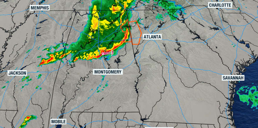
Operations at Hartsfield-Jackson Atlanta International Airport have improved after this morning’s thunderstorms forced a ground stop.
The rain isn’t over for the Peach State, as additional showers and thunderstorms will remain possible today before a cold front pushes through.
The greatest risk for severe weather is southwest of the metro, where the Storm Prediction Center has issued a Tornado Watch for parts of Alabama and Mississippi until 6 p.m. local time.
Birmingham and Montgomery are both included in the watch.
A tornado watch has been issued for parts of Alabama and Mississippi until 6 PM CST pic.twitter.com/zdev7Af9KY
— NWS Tornado (@NWStornado) November 25, 2025
Outside of the Southeast, weather conditions in the Midwest could become problematic late this evening.
All of this precipitation is tied to the same storm system, but across the Dakotas, Minnesota, Wisconsin and Michigan, enough cold air will be in place for snow.
Heavy snow has begun falling just south of Fargo, but it’s the system’s low clouds that are starting to cause problems at airports in Chicago.
The FAA reports departure delays of around 30 minutes, and impacts are increasing.
Elsewhere around the U.S., there are a few additional airport delays, but not because of the weather - just heavy air traffic.

Tuesday, 7:40 a.m.:
Dense Fog Advisories, Wind Advisories and Winter Storm Warnings are the most prolific alerts in effect across the country.
Most are centered over the Plains and Midwest, where communities will feel the impact of a strengthening storm system over the next 48 hours.
Forecast models have increased projected snow totals north of the Twin Cities, with a band of 6-8 inches possible across central Minnesota and northwest Wisconsin.

Additionally, wind gusts of upwards of 40-50 mph could produce near whiteout conditions, especially on Wednesday morning.
The worst of the wintry weather is expected to remain north of Interstate 94 and begin later on Tuesday.
As of Tuesday morning, the FAA reported no major airport delays from coast to coast, but that is likely to change as travelers begin their day.
A line of showers and thunderstorms west of Atlanta is occasionally becoming strong to severe and will push into the metro during the late morning.
The rain will likely slow traffic along Interstate 75 and through the nation’s busiest airport.

Most of the precipitation will stay north of the Sunshine State, but communities in the western Panhandle could see a few afternoon showers and thunderstorms.
Tuesday, 12:05 a.m.:
A storm system over the Northern Plains will continue moving eastward.
On the northern side of the system, snow showers will be possible Tuesday across the Dakotas and western Minnesota.
Precipitation will fall as rain elsewhere, including across the Great Lakes, Northeast and Southeast.

Nashville, Atlanta and Charlotte could see scattered showers with a few embedded thunderstorms.
Fog could once again be problematic for much of the Sunshine State during the early morning hours.
Tuesday will also be the last warm day across much of the nation, as colder air behind the front begins filtering into the northern tier on Wednesday.

Saturday, 12:30 a.m.
The holiday will be a transition day along the East Coast, with precipitation chances stretching from the Sunshine State to the Big Apple and into New England.
Parts of the Northeast could see the heaviest precipitation as energy from the storm system that moved through the Great Lakes phases with a new system forming offshore.
Fortunately, Thanksgiving Day is typically one of the quietest air-travel days of the year, so many travelers may avoid significant weather impacts.
A cold front will usher in a brief cooldown across the eastern half of the nation over the holiday weekend.


